History | Driving Tour | Images | Memorial | Maps | Contact
Welcome! This website will be a continual work in progress, please excuse the mess! Like and Follow us on Facebook @
1850 Dinsmore & Company's new and complete map of the railway system of the United States and Canada
Courtesy Illinois Library Digital Collections
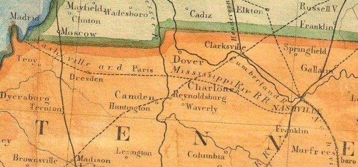
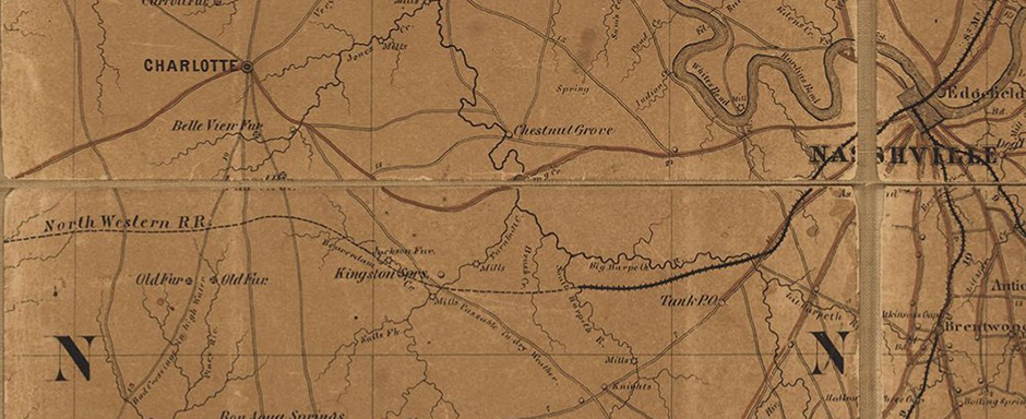
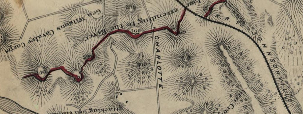
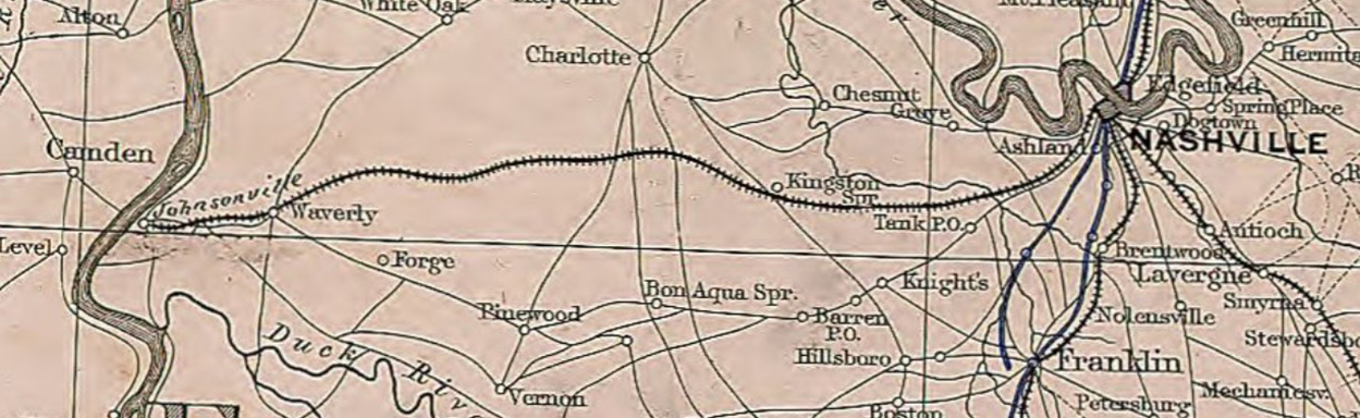
1852 map by Israel Andrews showing railroads in operation and progress, the Nashville & Northwestern is shown as the Nashville & Mississippi River Railroad, going by Charlotte
Courtesy of Wikimedia
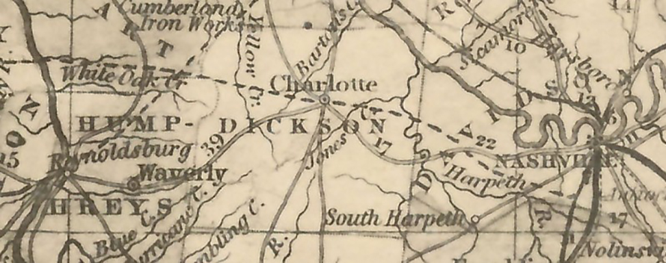
1854 map by Thomas, Cowperthwait & Co. showing steamboat, stage and railroad routes in 1854. The Nashville & Northwestern Railroad route is shown as "proposed", going through Charlotte and hitting the river north of Reynoldsburg.
Courtesy Tennessee State Library & Archives.
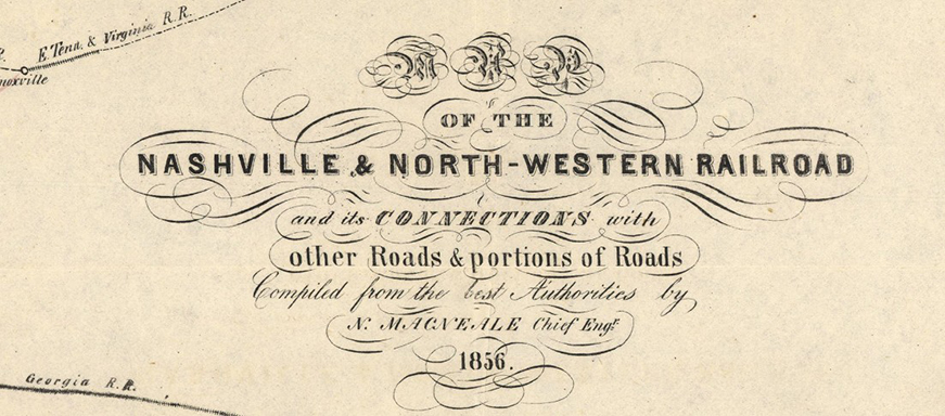
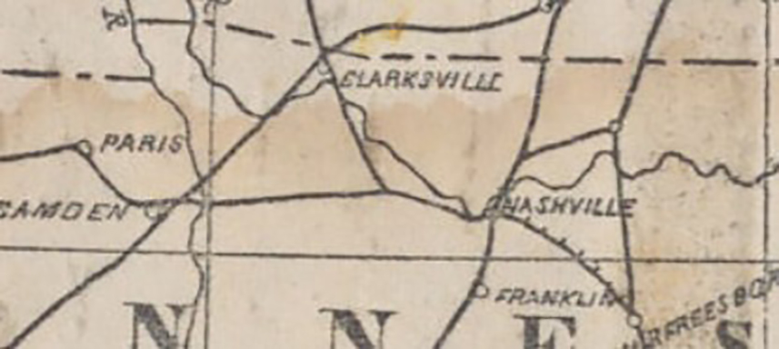
1856 map by N. MacNeale showing the Nashville & Northwestern Railroad route from Nashville to the Mississippi River
Courtesy Tennessee State Library & Archives.
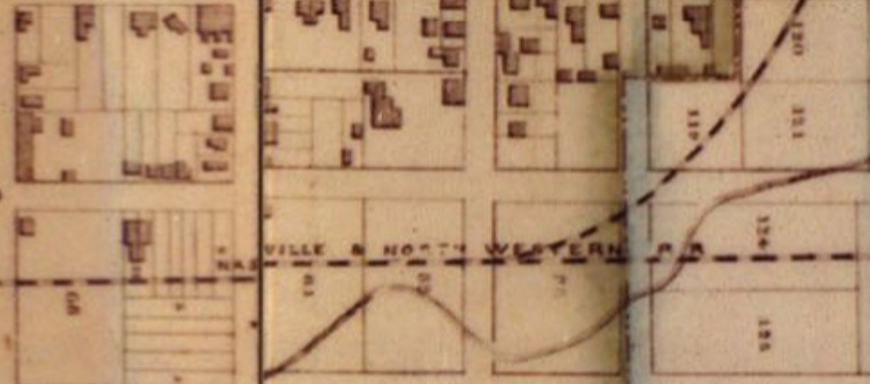
1860 Map of Nashville and Edgefield
Courtesy Tennessee State Library & Archives.
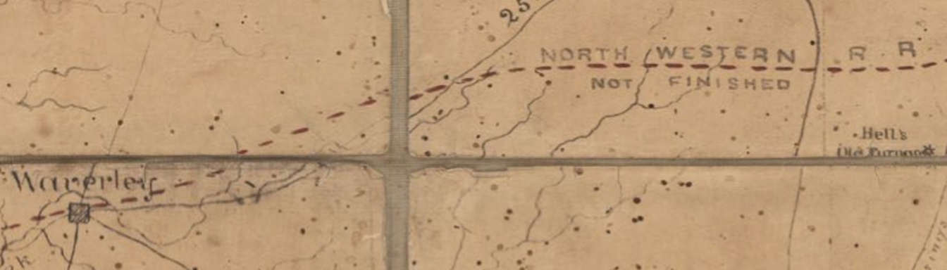
1862 map by Michler, N. (Nathaniel), 1827-1881; Weyss, J. E.; Mercell, C. S. showing unfinished route of the Nashville & Northwestern Railroad.
Courtesy Tennessee State Library & Archives.
1862 map by Benjamin Franklin Cheatham based on a federal map.
Courtesy Tennessee State Library & Archives.
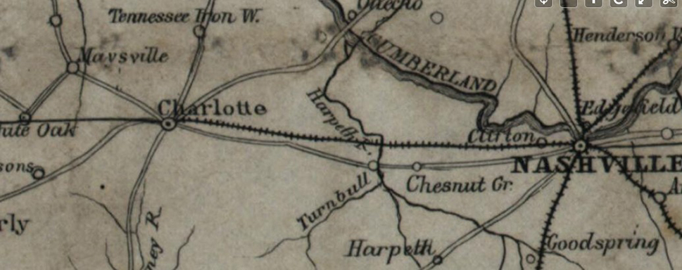
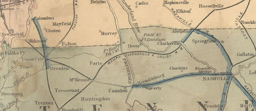
1862 map of Kentucky and Tennessee showing the Nashville & Northwestern Railroad going to Charlotte
Courtesy Library of Congress, Geography and Map Division.
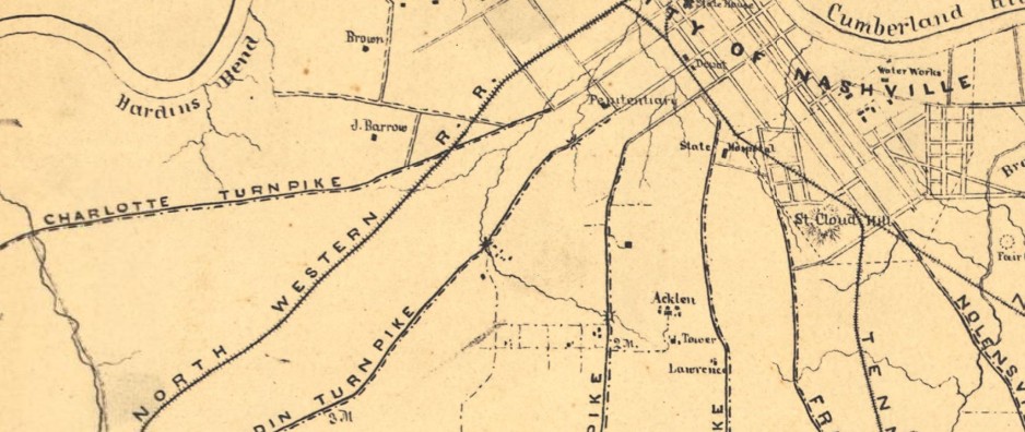
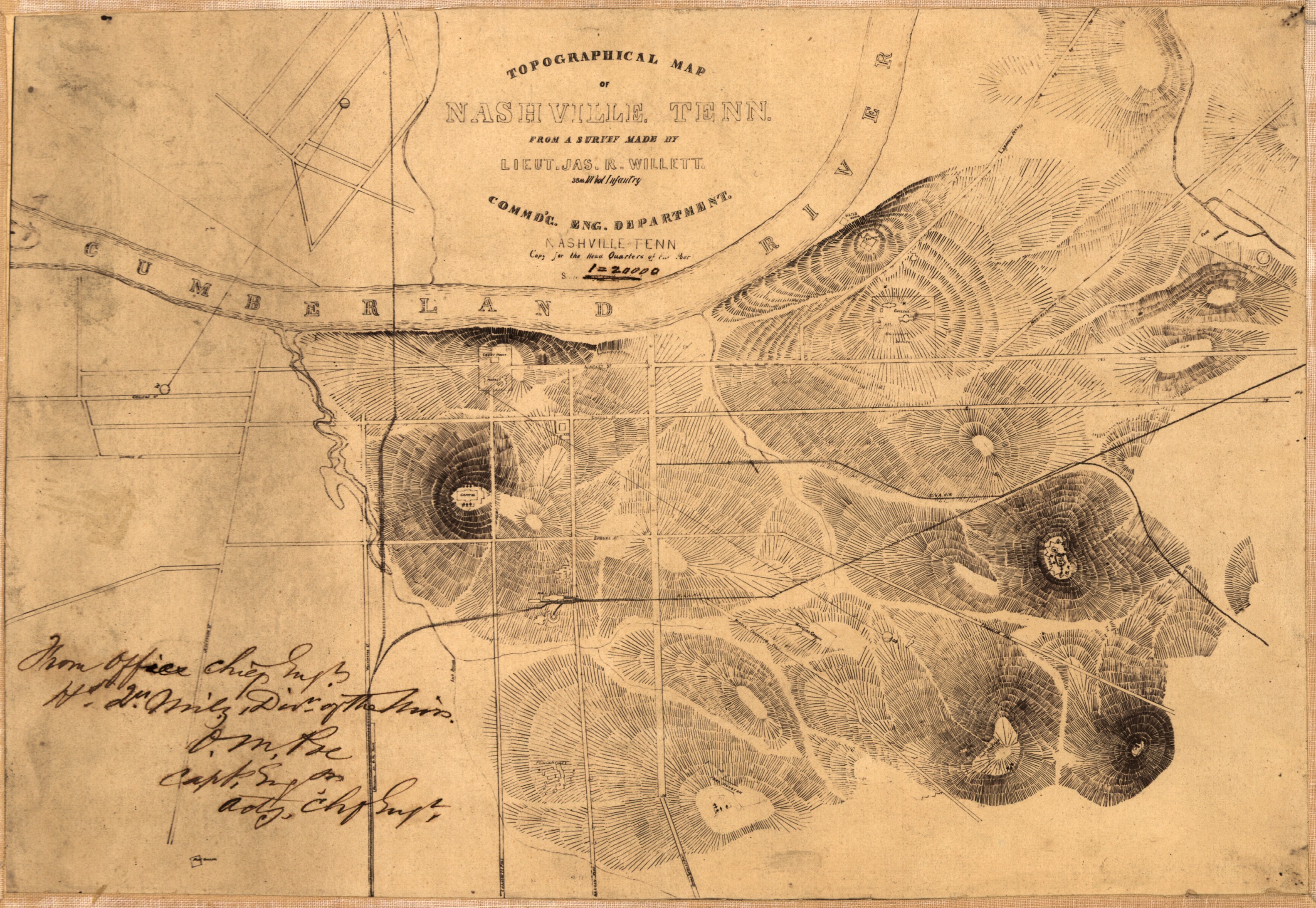
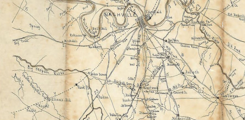
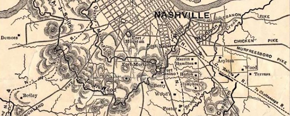
1862 Topographical map of the Environs of Nashville Tennessee
Courtesy Library of Congress, Geography and Map Division.
1863 map by Charles O. Perrine
Courtesy Tennessee State Library & Archives.
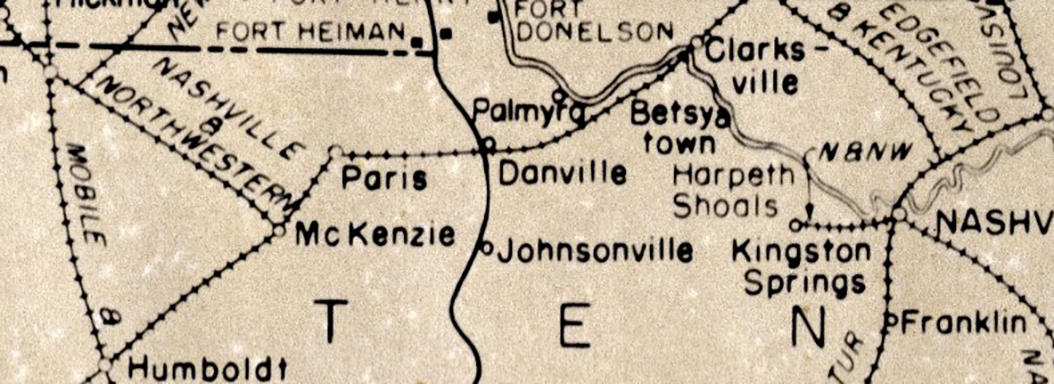
1863 map by James T Lloyd showing stops on the unifinished Nashville & Northwestern Railroad
Courtesy Tennessee State Library & Archives.
1863 map by William Emery Merrill (1837-1891) showing middle Tennessee (part 1)
Courtesy Tennessee State Library & Archives.
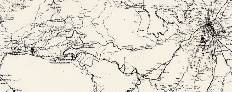
1863 map by William Emery Merrill (1837-1891) showing middle Tennessee (part 2)
Courtesy Tennessee State Library & Archives.
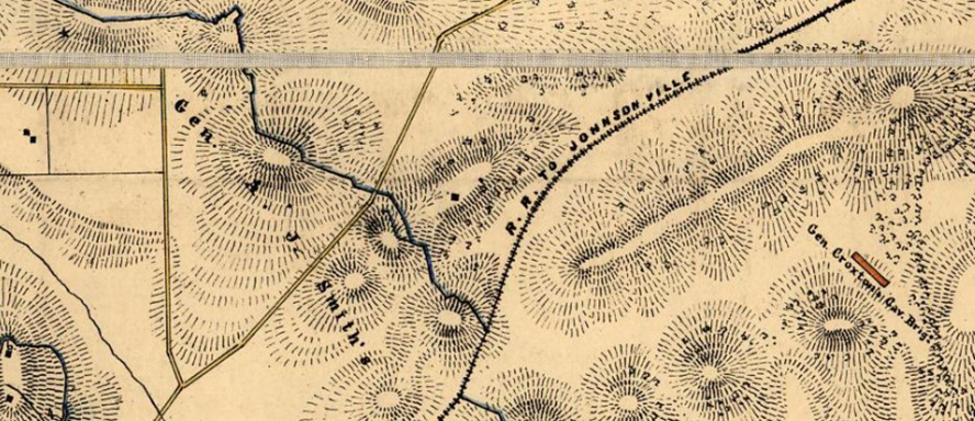
1863 map by G. H. Blakeslee Topo Engineer showing forts, camps and the Nashville & Northwestern Railroad
Civilwartalk.com
1863 Military map of the States of Kentucky and Tennessee
Courtesy Tennessee State Library & Archives.
1864 map from the Atlas to accompany the official records

1864 map from John Johnston's Civil War Reminiscences published in 1905. While not showing the railroad it shows the area between Charlotte and Hardin pikes where the railroad was.
Courtesy Tennessee State Library & Archives.
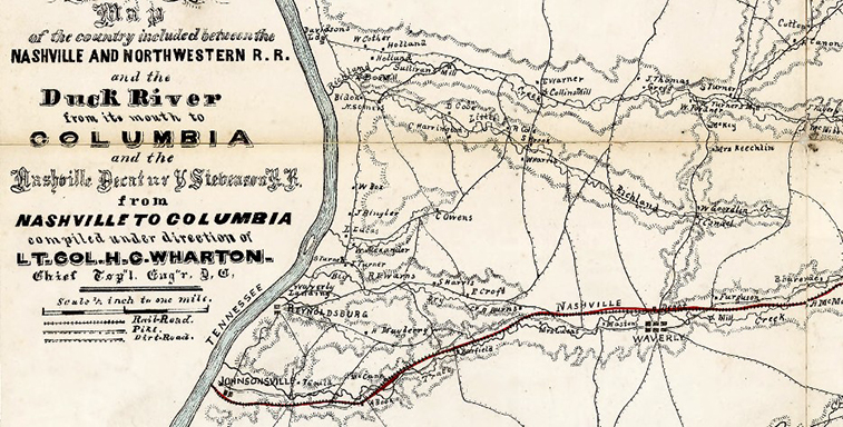
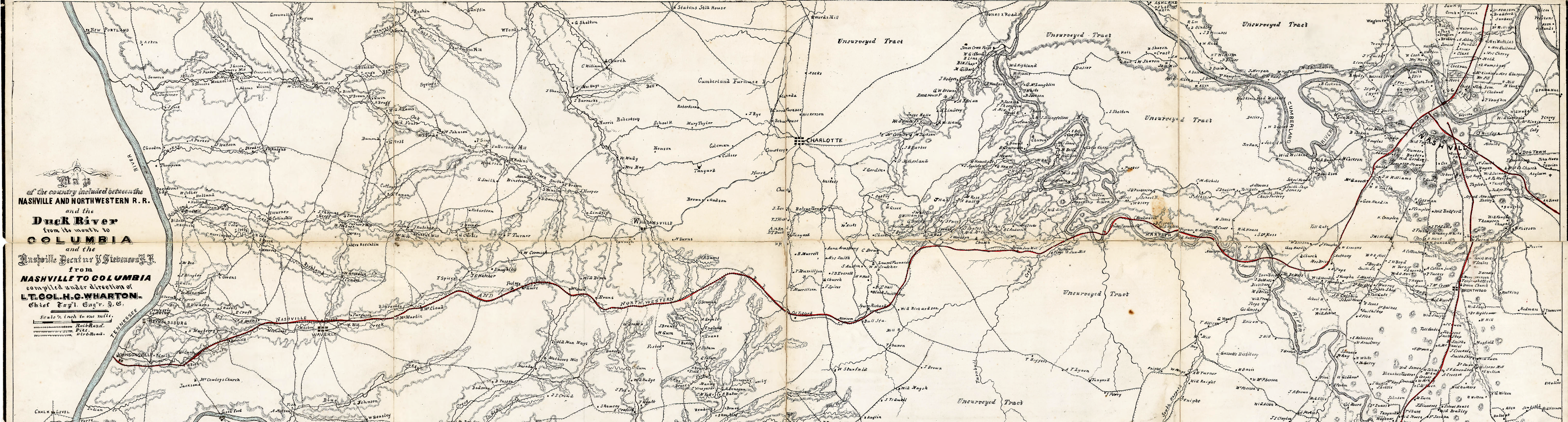
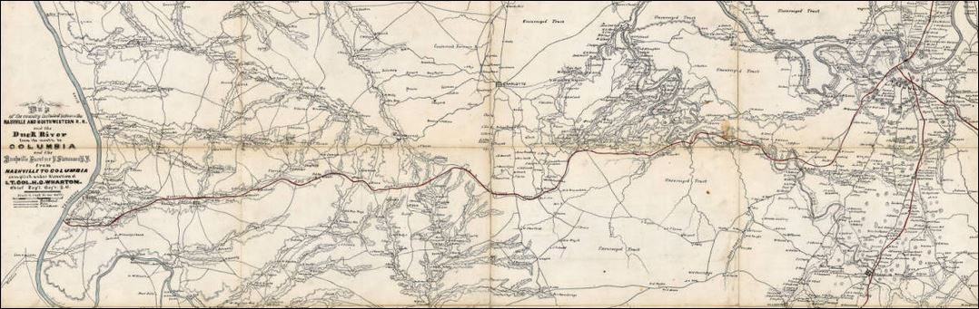
1864 map by Lt. Col. Harry C. Wharton showing the Nashville and Northwestern
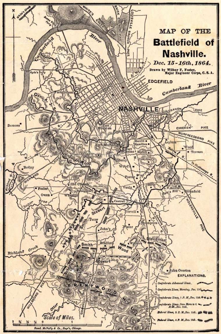
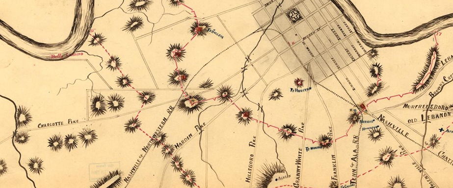
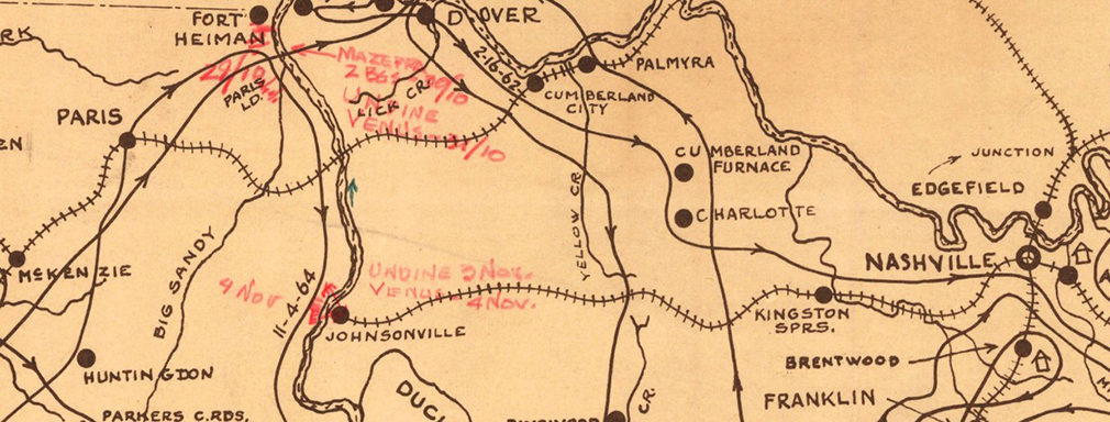
1864 Map of the Battlefield of Nashville. Dec. 15-16th, 1864 by Wilbur Foster, Major Engineer Corps CSA
https://classic.tnvacation.com/civil-war/lib/image/thumbs/-----34268_1_760_10000.jpg
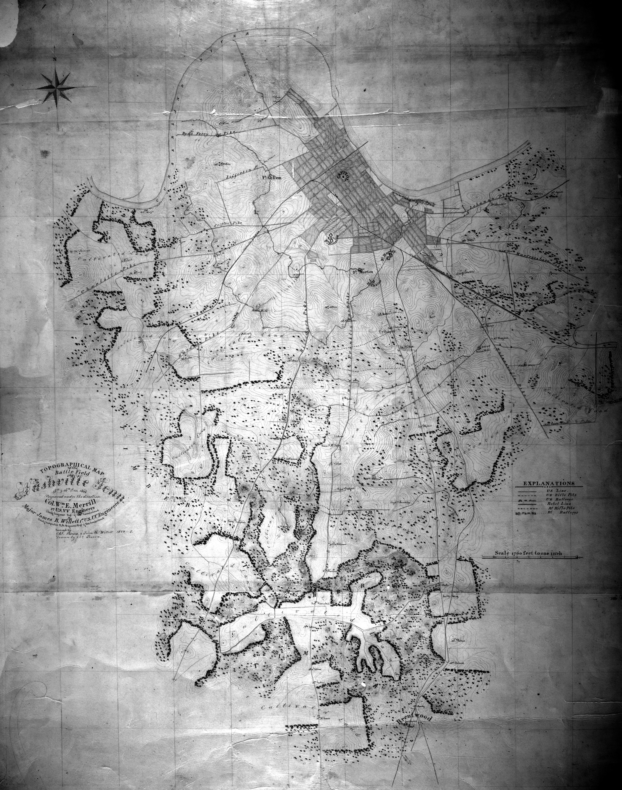
1864 may by Col. William E. Merrill of the 1st U.S. V.V. Engineers
https://www.battleofnashvilletrust.org/the-battle/maps/
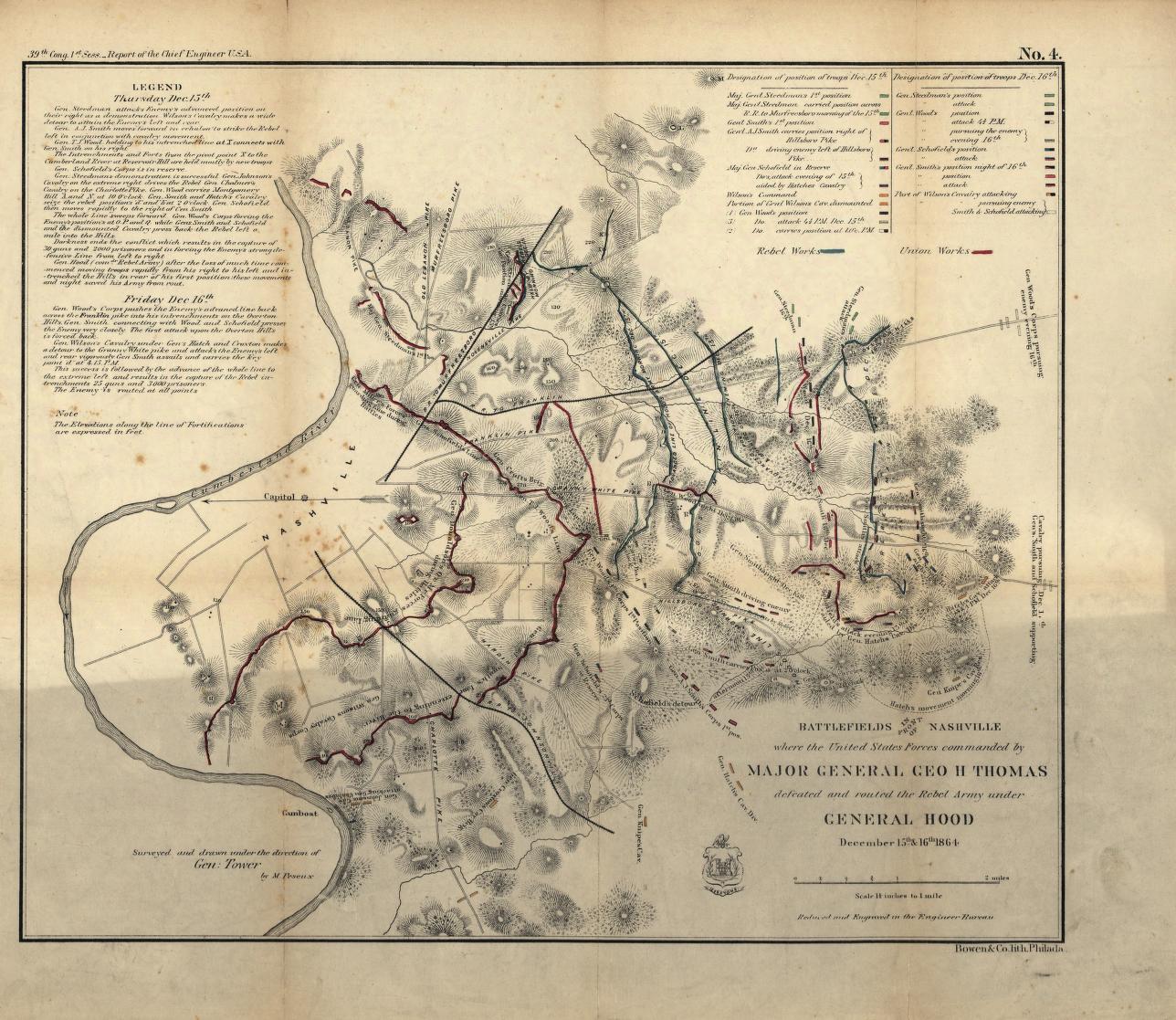
1864 map of the Battlefields in front of Nashville where the United States forces commanded by Major General Geo. H. Thomas defeated and routed the Rebel army under General Hood, December 15th & 16th, 1864
Courtesy Library of Congress, Geography and Map Division.
1864 map of the Battlefields in front of Nashville where the United States forces commanded by Major General Geo. H. Thomas defeated and routed the Rebel army under General Hood, December 15th & 16th, 1864
Courtesy Library of Congress, Geography and Map Division.

1864 map by Blakeslee titled Fourteen Trips Across Tennessee 1862-1864
Courtesy Library of Congress, Geography and Map Division.
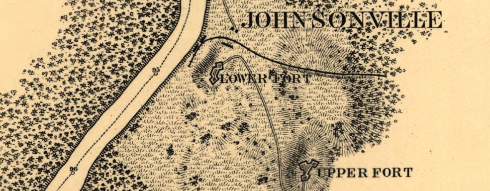
1865 map by Kossak, William; Muller, John B. on orders of General Sherman showing the Nashville & Northwestern railroad reaching the Tennessee River at Johnsonville
Courtesy Tennessee State Library & Archives.
1865 Map of the Tennessee River for the use of the Mississippi Squadron
Courtesy Library of Congress, Geography and Map Division.
1865 Military Map of Middle Tennessee and parts of East Tennessee and the adjoining states
Courtesy Library of Congress, Geography and Map Division.
1865 (undated) map originally from Byrd Douglas Papers showing the railroads during the civil war
Courtesy Tennessee State Library & Archives.
1865 Map No. 55 of Western Tennessee and part of Kentucky
Courtesy
1866 map of Military Railroads operated from 1862 to 1866. The Nashville & Northwestern Railroad is shown as running 5ft guage track
Courtesy Tennessee State Library & Archives.
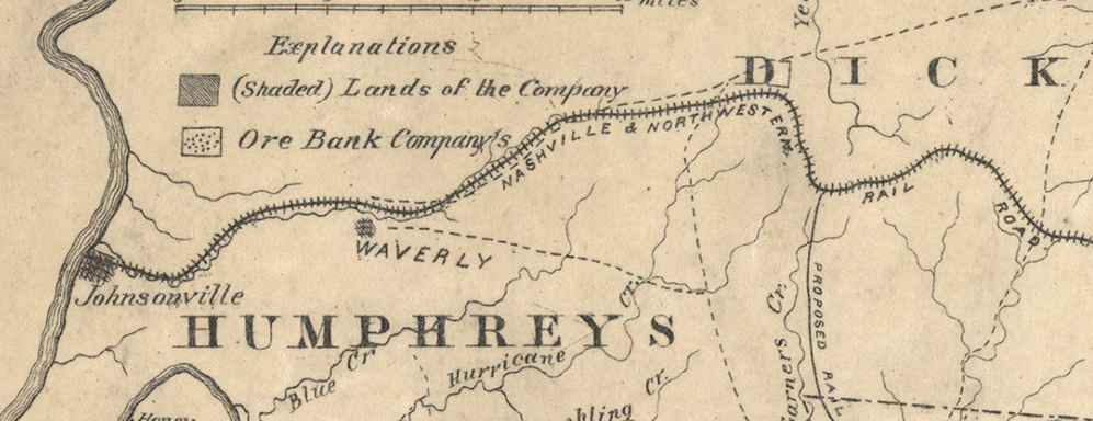
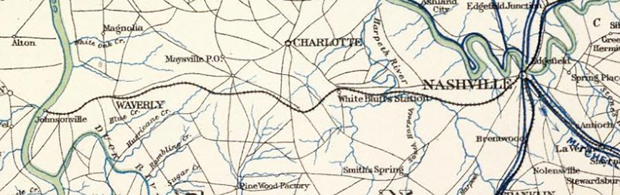
1868 map showing Aetna Iron manufacturing, mining and oil company property in Tennessee, showing the Nashville & Northwestern Railroad
Courtesy Tennessee State Library & Archives.
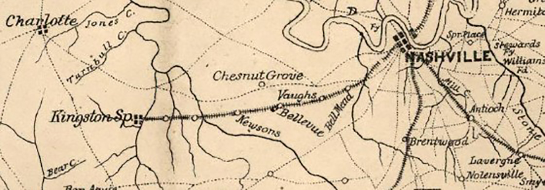
1871 Map of Davidson County by Wilbur Foster
Courtesy Tennessee State Library & Archives.
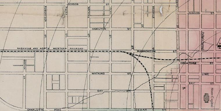
1873 Plan of the City of Nashville and vicinity
Courtesy Tennessee State Library & Archives.
Map by W. R. Plum published in 1882 of the Theatre in central Kentucky and eastern Tennessee, also in Missouri and Arkansas.
Courtesy Library of Congress, Geography and Map Division.
1895 Published map prepared to exhibit the campaigns in which the Army of the Cumberland took part during the war of the rebellion
1941 map drawn in the 1940s by Monroe Cockrell of Confederate Gen. Nathan Bedford Forrest extensive cavalry campaigns in Tennessee, Alabama and Mississippi.
Courtesy Tennessee State Library & Archives.
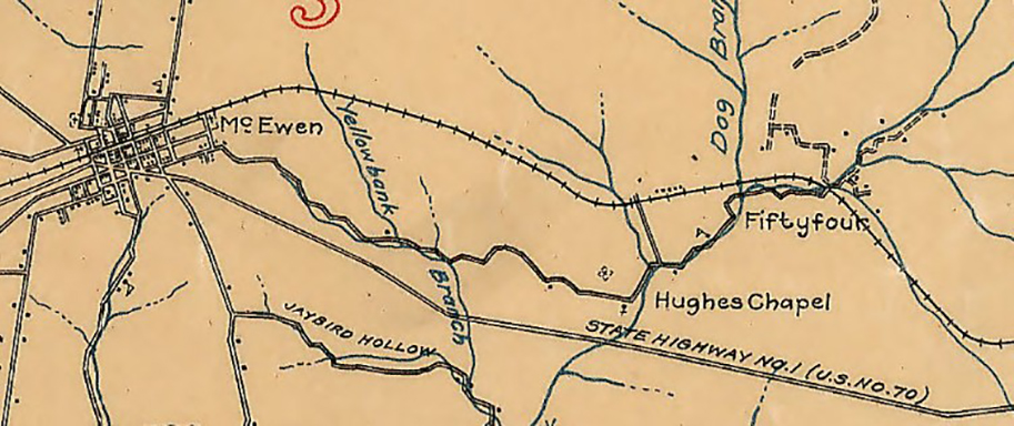
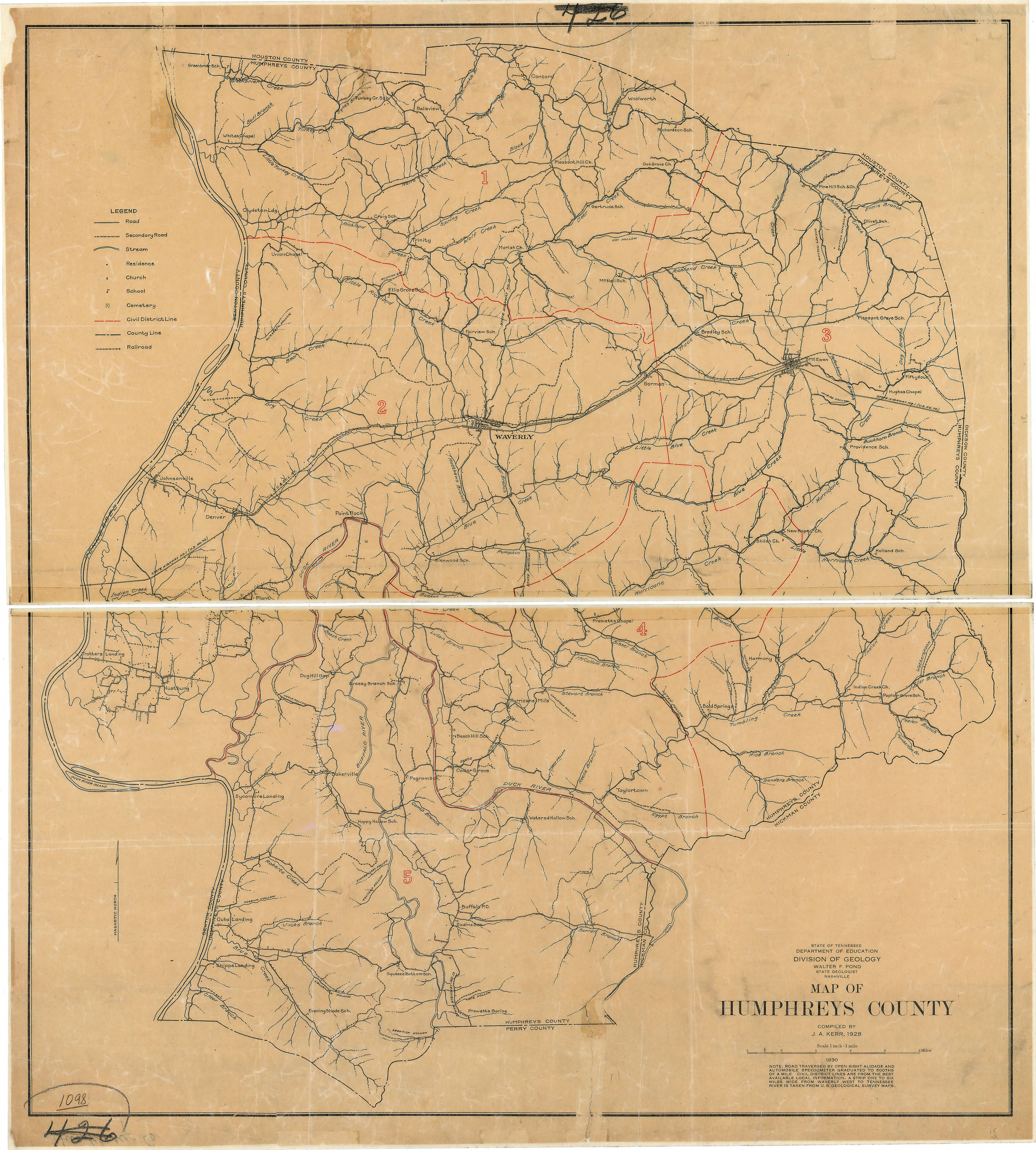
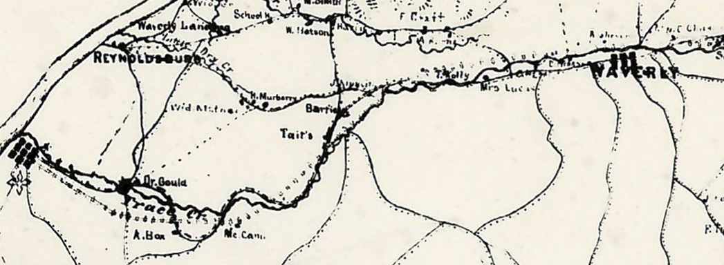
1928 map of Humphrey's County showing the railroad and the community of "Fiftyfour", 54 miles from Nashville on the railroad
Courtesy Tennessee State Library & Archives.
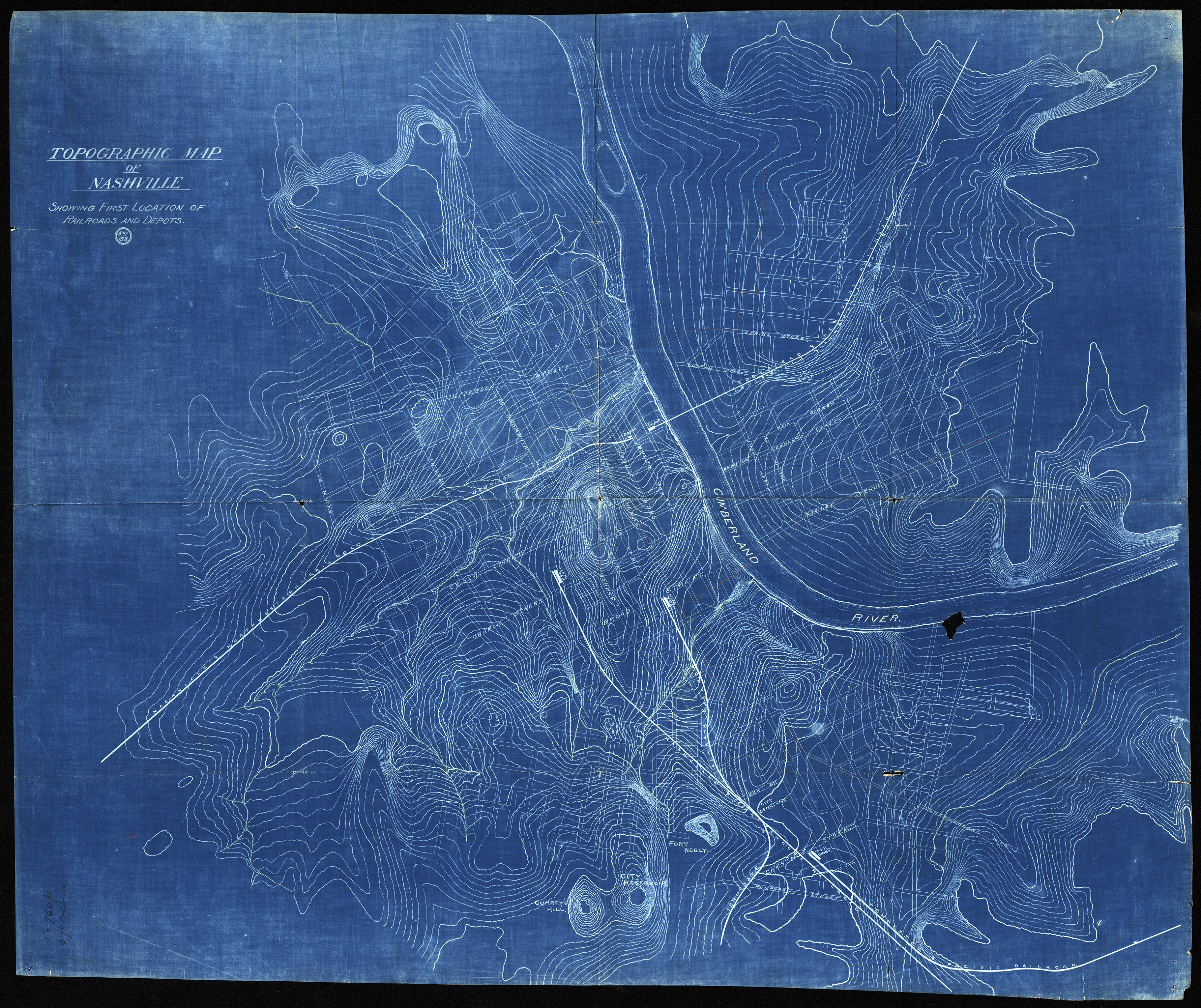
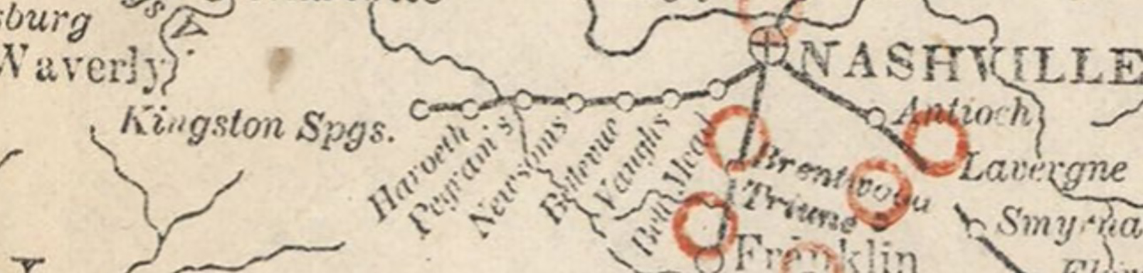
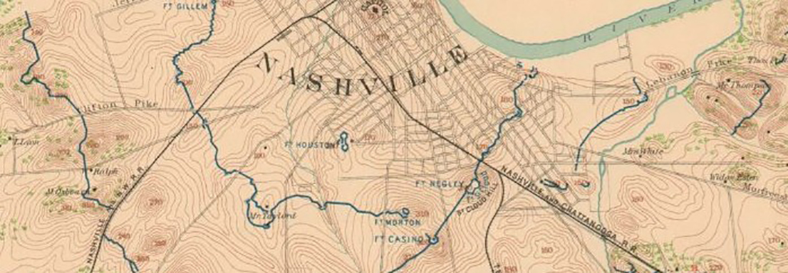
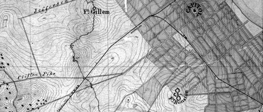
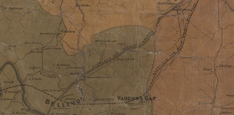
An undated topographical map of the Nashville area showing the Nashville & Northwestern Railroad
Courtesy Tennessee State Library & Archives.
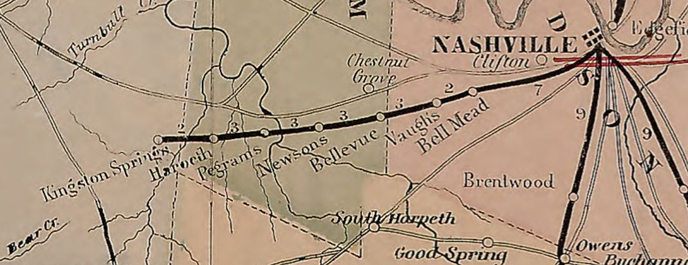
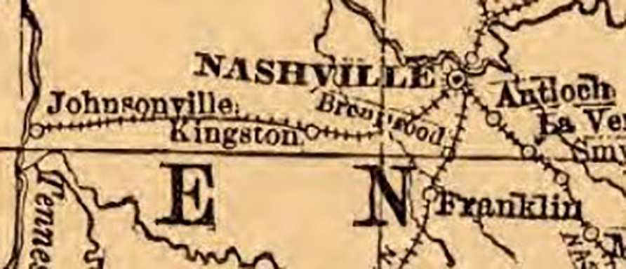
Undated survey map for the Louisville & Nashville Railroad also showing Nashville & Northwestern Railroad
Courtesy Tennessee State Library & Archives.
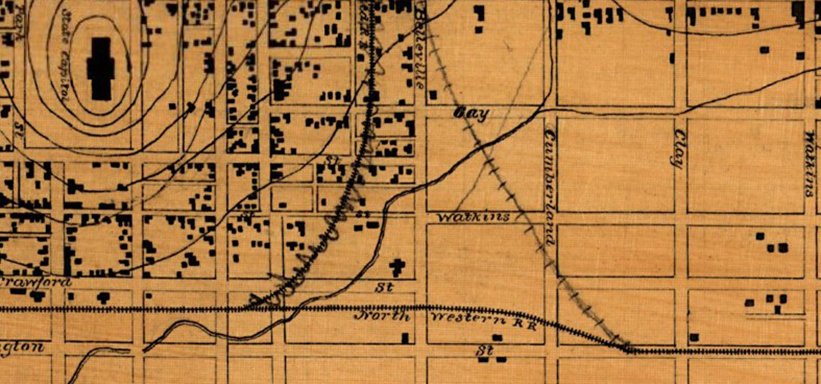
Undated Map of Nashville Tennessee by Orlando Matcalfe Poe, Chief Engrs. Office
Courtesy Library of Congress, Geography and Map Division.

Undated Topographical Map of Nashville Tennessee
Courtesy Library of Congress, Geography and Map Division.